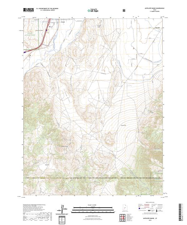
2023 Map of Antelope Range
USGS Topo · Published 2023About this map
The Sevier River and its accompanying irrigation works, such as the Sevier-Valley Canal and South Bend Canal, define the agricultural life of this valley south of Elsinore. This modern record shows the enduring footprint of settlements like Joseph and the outskirts of Monroe, where local history is anchored by the Joseph Cem and Sevier Cem. The landscape transitions sharply from the irrigated Joseph Flats to the arid elevations of the Antelope Range and the Bald Knolls.
Find a feature on this map
46 named features on this map. Tap any name to fly to it.
Don’t see what you’re looking for? This feature index may not catch every label — zoom into the map to look around manually.
Map Details
Editions of this 2023 Antelope Range Map
This is the sole edition of this map. No revisions or reprints were ever made.
Other maps of this area

1885 · Beaver
USGS Topo · 1:250,000

1932 · Sevier
USGS Topo · 1:62,500

1935 · Sevier
USGS Topo · 1:62,500

1937 · Delano Peak
USGS Topo · 1:48,000

1940 · Monroe
USGS Topo · 1:62,500

1943 · Delano Peak
USGS Topo · 1:62,500

1944 · Monroe
USGS Topo · 1:62,500

1945 · Marysvale
USGS Topo · 1:62,500

1947 · Marysvale
USGS Topo · 1:62,500

1953 · Richfield
USGS Topo · 1:250,000