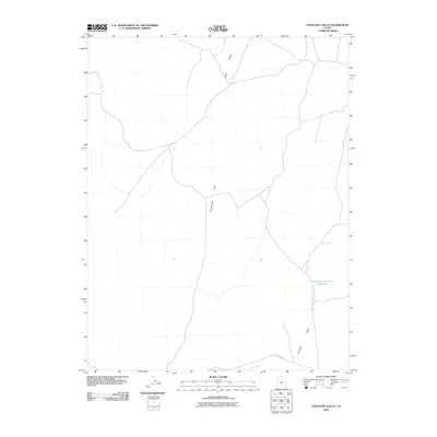
2010 Map of Antelope Valley
USGS Topo · Published 2010About this map
Government Pass serves as a central transit point through the high terrain of Millard County, connecting the open stretches of Antelope Valley with the surrounding volcanic topography. The landscape is defined by geological features such as Lava Ridge, which overlooks a network of local roads and intermittent water sources. Water management in this arid environment is evidenced by the South Horse Hollow Reservoir in the eastern portion of the quadrangle. Along the southern boundary, Black Rock Rd and Cove Creek provide further navigation through a region primarily shaped by its remote volcanic geography and drainage patterns. This survey provides a look at the infrastructure required to traverse this part of the Great Basin at the turn of the 21st century.
Find a feature on this map
6 named features on this map. Tap any name to fly to it.
Don’t see what you’re looking for? This feature index may not catch every label — zoom into the map to look around manually.
Map Details
Editions of this 2010 Antelope Valley Map
This is the sole edition of this map. No revisions or reprints were ever made.
Other maps of this area

1885 · Beaver
USGS Topo · 1:250,000

1953 · Richfield
USGS Topo · 1:250,000

1958 · Richfield
USGS Topo · 1:250,000

1962 · Tabernacle Hill
USGS Topo · 1:62,500

1962 · Cove Fort
USGS Topo · 1:62,500

1973 · Cruz
USGS Topo · 1:24,000

1973 · Pinnacle Pass
USGS Topo · 1:24,000

1973 · Antelope Spring
USGS Topo · 1:24,000

1980 · Richfield
USGS Topo · 1:100,000
1986 · Sixmile Point
USGS Topo · 1:24,000