
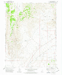
1973 Map of Antelope Spring
USGS Topo · Published 1976About this map
Antelope Mountains dominate the southern portion of this Millard County landscape, a region characterized by remote peaks and scattered resource extraction during the early 1970s. The presence of multiple Mines and various Prospects across the slopes and valley floors indicates a history of mineral exploration in the high desert. Water, a critical commodity in this arid terrain, is marked at Antelope Spring and Cove Spring, providing essential landmarks for surveyors and travelers alike.
Find a feature on this map
15 named features on this map. Tap any name to fly to it.
Don’t see what you’re looking for? This feature index may not catch every label — zoom into the map to look around manually.
Map Details
Editions of this 1973 Antelope Spring Map
This is the sole edition of this map. No revisions or reprints were ever made.
Other maps of this area

1885 · Beaver
USGS Topo · 1:250,000

1953 · Richfield
USGS Topo · 1:250,000

1958 · Richfield
USGS Topo · 1:250,000

1962 · Tabernacle Hill
USGS Topo · 1:62,500

1962 · Cove Fort
USGS Topo · 1:62,500

1973 · Cruz
USGS Topo · 1:24,000

1973 · Pinnacle Pass
USGS Topo · 1:24,000

1973 · Black Rock
USGS Topo · 1:24,000

1973 · Read
USGS Topo · 1:24,000
1973 · Cat Canyon
USGS Topo · 1:24,000