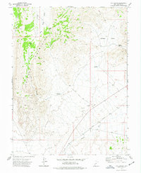
1973 Map of Cat Canyon
USGS Topo · Published 1977About this map
The Cricket Mountains dominate the western half of this Millard County landscape, defining a series of high ridges and narrow passes. During this mid-1970s survey, the area reflects a transition from the rugged mountain terrain to the alluvial basins of Sage Valley and Georges Valley. Connectivity through the range is marked by topographic gaps such as Cedar Pass, Red Pass, and Georges Pass, which served as historical conduits across the upland barrier.
Find a feature on this map
16 named features on this map. Tap any name to fly to it.
Don’t see what you’re looking for? This feature index may not catch every label — zoom into the map to look around manually.
Map Details
Editions of this 1973 Cat Canyon Map
This is the sole edition of this map. No revisions or reprints were ever made.
Other maps of this area

1885 · Beaver
USGS Topo · 1:250,000

1953 · Richfield
USGS Topo · 1:250,000

1958 · Richfield
USGS Topo · 1:250,000

1960 · Beaver Lake Mts.
USGS Topo · 1:62,500

1972 · Headlight Mtn
USGS Topo · 1:24,000
1972 · Sevier Lake NE
USGS Topo · 1:24,000

1973 · Cruz
USGS Topo · 1:24,000

1973 · Antelope Spring
USGS Topo · 1:24,000
1973 · Borden
USGS Topo · 1:24,000

1973 · Black Rock
USGS Topo · 1:24,000