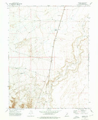
1973 Map of Borden
USGS Topo · Published 1976About this map
Union Pacific rail lines dominate the north-south axis of this Millard County landscape, connecting the small settlements of Borden and Bloom during the early 1970s. The terrain is defined by the winding course of the Beaver River, which carves through the eastern and southern portions of the quadrangle. This semi-arid region shows a reliance on managed water resources, as evidenced by the Borden Basin Reservoir and Halls Double Res located among the western ridges.
Find a feature on this map
11 named features on this map. Tap any name to fly to it.
Don’t see what you’re looking for? This feature index may not catch every label — zoom into the map to look around manually.
Map Details
Editions of this 1973 Borden Map
This is the sole edition of this map. No revisions or reprints were ever made.
Other maps of this area

1885 · Beaver
USGS Topo · 1:250,000

1885 · Sevier Desert
USGS Topo · 1:250,000

1953 · Richfield
USGS Topo · 1:250,000

1953 · Delta
USGS Topo · 1:250,000

1958 · Richfield
USGS Topo · 1:250,000

1958 · Delta
USGS Topo · 1:250,000

1962 · Delta
USGS Topo · 1:250,000

1962 · Tabernacle Hill
USGS Topo · 1:62,500

1971 · Red Pass
USGS Topo · 1:24,000

1971 · Neels
USGS Topo · 1:24,000