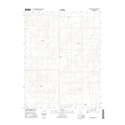
2017 Map of Antelope Valley
USGS Topo · Published 2017About this map
Antelope Valley defines the southern reach of this Millard County landscape, where the terrain shifts toward the geological transition of Lava Ridge to the north. A critical passage through the high ground is found at Government Pass, providing a natural corridor for movement across the desert heights. The map details the water management systems essential for this arid region, most notably the S Horse Hollow Reservoir and the drainage of Cove Cr in the south. These features, along with the thoroughfare of Black Rock Rd, reflect a landscape primarily shaped by topography and the strategic location of seasonal water sources rather than dense settlement.
Find a feature on this map
10 named features on this map. Tap any name to fly to it.
Don’t see what you’re looking for? This feature index may not catch every label — zoom into the map to look around manually.
Map Details
Editions of this 2017 Antelope Valley Map
This is the sole edition of this map. No revisions or reprints were ever made.
Other maps of this area

1885 · Beaver
USGS Topo · 1:250,000

1953 · Richfield
USGS Topo · 1:250,000

1958 · Richfield
USGS Topo · 1:250,000

1962 · Tabernacle Hill
USGS Topo · 1:62,500

1962 · Cove Fort
USGS Topo · 1:62,500

1973 · Cruz
USGS Topo · 1:24,000

1973 · Pinnacle Pass
USGS Topo · 1:24,000

1973 · Antelope Spring
USGS Topo · 1:24,000

1980 · Richfield
USGS Topo · 1:100,000
1986 · Sixmile Point
USGS Topo · 1:24,000