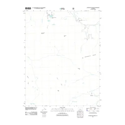
2011 Map of Anthracite Range
USGS Topo · Published 2011About this map
The Anthracite Range dominates this corner of Gunnison County, characterized by high-altitude passes and the drainage networks of the Ruby Anthracite Creek and Cliff Creek. This landscape reflects a history of seasonal mountain industry and recreation, centered around features like the Ruby Mine and the Castle Creek Cow Camp. The hydrologic engineering of the E Beckwith Number 1 Dam at Lost Lake Slough manages water resources near East Beckwith Mountain, while numerous trails and secondary roads such as Co RD 12 provide access to backcountry landmarks. From the elevations of Storm Ridge to the low-lying waters of Costo Lake, the map traces the intersection of mining interests and ranching outposts within the National Forest system. These features illustrate the enduring use of the Colorado high country for extraction and grazing long into the modern era.
Find a feature on this map
28 named features on this map. Tap any name to fly to it.
Don’t see what you’re looking for? This feature index may not catch every label — zoom into the map to look around manually.
Map Details
Editions of this 2011 Anthracite Range Map
This is the sole edition of this map. No revisions or reprints were ever made.
Other maps of this area

1888 · Anthracite
USGS Topo · 1:62,500

1889 · Anthracite
USGS Topo · 1:62,500

1893 · Anthracite
USGS Topo · 1:62,500

1894 · Anthracite
USGS Topo · 1:62,500

1938 · Mt. Gunnison
USGS Topo · 1:48,000

1945 · Mount Gunnison
USGS Topo · 1:62,500

1956 · Montrose
USGS Topo · 1:250,000

1959 · Montrose
USGS Topo · 1:250,000

1960 · Montrose
USGS Topo · 1:250,000
1961 · Oh-Be-Joyful
USGS Topo · 1:24,000