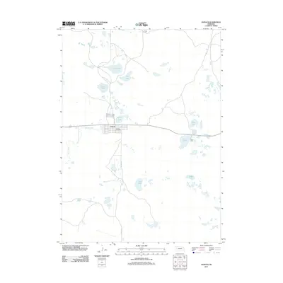
2011 Map of Antioch
USGS Topo · Published 2011About this map
Antioch sits as the central hub of this Sandhills landscape, anchored by the Antioch Post Office and a grid of residential streets near the intersection of Antioch Ave and Rogers Ave. The area is characterized by a dense network of alkaline and freshwater bodies, including Potash Lake and Snake Creek, reflecting the region’s unique hydrology. These lakes provided the foundation for local industry and ranching, with the McFall Ranch and Johnston Ranch established near essential water sources like Wilson Lake and Bower Lake. Local transit is facilitated by rural routes such as Road No 155, which connects the small settlement to the surrounding pastoral lands. For the researcher, the map identifies specific family-named landmarks and a high concentration of wetlands, such as Lily Lake and Hiers Lakes, which have shaped the settlement patterns and economic history of Sheridan County.
Find a feature on this map
16 named features on this map. Tap any name to fly to it.
Don’t see what you’re looking for? This feature index may not catch every label — zoom into the map to look around manually.
Map Details
Editions of this 2011 Antioch Map
This is the sole edition of this map. No revisions or reprints were ever made.
Other maps of this area

1896 · Browns Creek
USGS Topo · 1:125,000

1899 · Browns Creek
USGS Topo · 1:125,000

1948 · Antioch
USGS Topo · 1:62,500

1948 · Lakeside
USGS Topo · 1:62,500

1949 · Mumper
USGS Topo · 1:62,500

1949 · Antioch
USGS Topo · 1:62,500

1950 · Storm Lake
USGS Topo · 1:62,500

1950 · Lakeside
USGS Topo · 1:62,500

1954 · Scottsbluff
USGS Topo · 1:250,000

1955 · Alliance
USGS Topo · 1:250,000