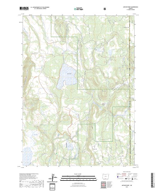
2023 Map of Antler Point
USGS Topo · Published 2023About this map
Fremont National Forest spans this high-country landscape, where the boundary between Klamath and Lake counties meets. The terrain is defined by a series of open basins and meadows, including Bear Valley, Strawberry Flat, and Johnson Meadow, which historically provided vital forage and water for ranching and wildlife. Water management is evident through features like Cronin Reservoir and Grohs Reservoir, alongside numerous family-named and descriptive water sources such as Log Cabin Spring, Rock Camp Spring, and Cronin Spring. The prominence of Antler Point overlooks Long Valley, while the southern reaches descend toward Sorghum Flat and Adobe Flat. This network of springs and drainages like Wild Horse Creek and Willow Creek illustrates the complex hydrology required to sustain life in this high-desert forest environment.
Find a feature on this map
42 named features on this map. Tap any name to fly to it.
Don’t see what you’re looking for? This feature index may not catch every label — zoom into the map to look around manually.
Map Details
Editions of this 2023 Antler Point Map
This is the sole edition of this map. No revisions or reprints were ever made.
Other maps of this area

1886 · Alturas
USGS Topo · 1:250,000

1886 · Modoc Lava Bed
USGS Topo · 1:250,000

1889 · Klamath
USGS Topo · 1:250,000

1892 · Modoc Lava-Bed
USGS Topo · 1:250,000

1892 · Alturas
USGS Topo · 1:250,000

1894 · Klamath
USGS Topo · 1:250,000

1951 · Clear Lake Reservoir
USGS Topo · 1:62,500

1954 · Alturas
USGS Topo · 1:250,000

1955 · Klamath Falls
USGS Topo · 1:250,000

1958 · Alturas
USGS Topo · 1:250,000