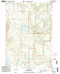
2004 Map of Antler Point
USGS Topo · Published 2007About this map
Gerber Reservoir dominates the southern landscape of this high-country terrain along the border of Klamath and Lake counties. Managed within the Fremont National Forest, the region is defined by a complex network of seasonal water sources and volcanic landmarks like Strawberry Butte. The land's utility is marked by features such as the Levee near the reservoir and scattered industrial sites including a Cinder Pit and Gravel Pit.
Find a feature on this map
38 named features on this map. Tap any name to fly to it.
Don’t see what you’re looking for? This feature index may not catch every label — zoom into the map to look around manually.
Map Details
Editions of this 2004 Antler Point Map
This is the sole edition of this map. No revisions or reprints were ever made.
Other maps of this area

1886 · Alturas
USGS Topo · 1:250,000

1886 · Modoc Lava Bed
USGS Topo · 1:250,000

1889 · Klamath
USGS Topo · 1:250,000

1892 · Modoc Lava-Bed
USGS Topo · 1:250,000

1892 · Alturas
USGS Topo · 1:250,000

1894 · Klamath
USGS Topo · 1:250,000

1951 · Clear Lake Reservoir
USGS Topo · 1:62,500

1954 · Alturas
USGS Topo · 1:250,000

1955 · Klamath Falls
USGS Topo · 1:250,000

1958 · Alturas
USGS Topo · 1:250,000