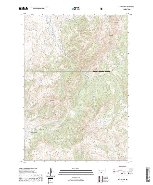
2024 Map of Antone Peak
USGS Topo · Published 2024About this map
Beaverhead National Forest defines the high-altitude landscape shown in this contemporary study of the Montana backcountry. Centered on the rugged Snowcrest Range, the terrain is marked by prominent summits including Antone Peak and Sawtooth Mtn, which rise above a complex network of drainage basins. The map illustrates a vital watershed for the region, where headwaters such as Taylor Creek and the East Fork Blacktail Deer Creek begin their descent. Human presence is light, concentrated primarily on forest access corridors like Antone Rd and E Fork Blacktail Rd. Localized landmarks like Srybold Spring and Antone Pass serve as key navigational points for those navigating the high country between Madison and Beaverhead Counties.
Find a feature on this map
32 named features on this map. Tap any name to fly to it.
Don’t see what you’re looking for? This feature index may not catch every label — zoom into the map to look around manually.
Map Details
Editions of this 2024 Antone Peak Map
This is the sole edition of this map. No revisions or reprints were ever made.
Other maps of this area

1955 · Dubois
USGS Topo · 1:250,000

1958 · Dubois
USGS Topo · 1:250,000

1968 · Stonehouse Mountain
USGS Topo · 1:24,000

1968 · Whiskey Spring
USGS Topo · 1:24,000

1968 · Lima Dam
USGS Topo · 1:24,000
1968 · Price Creek NE
USGS Topo · 1:24,000

1968 · Antelope Peak
USGS Topo · 1:24,000

1968 · Antone Peak
USGS Topo · 1:24,000
1968 · Swamp Creek
USGS Topo · 1:24,000
1968 · Wolverine Creek
USGS Topo · 1:24,000