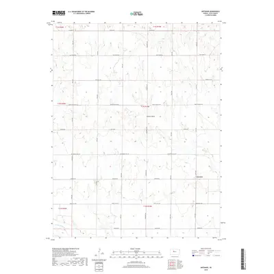
2018 Map of Antonino
USGS Topo · Published 2018About this map
Antonino serves as the central settlement point in this section of Ellis County, where a grid of rural avenues and roads divides the Kansas prairie. The topography is defined by the drainage patterns of the Smoky Hill River in the south and the distinct landform of Lookout Hollow further north. Historical transportation routes are highlighted by the presence of Butterfield Trail Rd, a name recalling the mid-19th century stagecoach and freight line that once crossed these plains. The map illustrates a landscape primarily shaped by section-line farming and the gradual descent toward the river valley, with local routes like Munjor Rd and Victoria Rd connecting the scattered farmsteads and agricultural plots of the High Plains.
Find a feature on this map
24 named features on this map. Tap any name to fly to it.
Don’t see what you’re looking for? This feature index may not catch every label — zoom into the map to look around manually.
Map Details
Editions of this 2018 Antonino Map
This is the sole edition of this map. No revisions or reprints were ever made.
Other maps of this area

1893 · Ellis
USGS Topo · 1:125,000

1896 · Hays
USGS Topo · 1:125,000

1955 · Great Bend
USGS Topo · 1:250,000

1957 · Great Bend
USGS Topo · 1:250,000

1958 · Great Bend
USGS Topo · 1:250,000

1961 · Yocemento
USGS Topo · 1:24,000

1961 · Hays South
USGS Topo · 1:24,000
1961 · Hays North
USGS Topo · 1:24,000

1961 · Antonino
USGS Topo · 1:24,000
1961 · Ellis
USGS Topo · 1:24,000