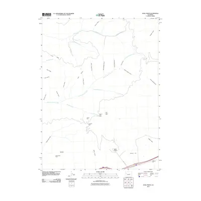
2010 Map of Anvil Points
USGS Topo · Published 2010About this map
The Anvil Points Oil Shale Mines and the Rulison Oil Shale Mine define the industrial history of this Colorado landscape, situated along the steep slopes of the Roan Plateau. This 2010 survey records the intricate drainage system of the area, where East Fork Parachute Creek and Northwater Creek carve through the high terrain. The map captures the significant elevation changes between landmarks such as West Anvil Point and East Anvil Point down to the southern valley floor along Highway 6 and 24.
Find a feature on this map
39 named features on this map. Tap any name to fly to it.
Don’t see what you’re looking for? This feature index may not catch every label — zoom into the map to look around manually.
Map Details
Editions of this 2010 Anvil Points Map
This is the sole edition of this map. No revisions or reprints were ever made.
Other maps of this area

1906 · Grand Hogback
USGS Topo · 1:125,000

1910 · Grand Hogback
USGS Topo · 1:125,000

1925 · Parachute Creek
USGS Topo · 1:62,500

1927 · Parachute Creek
USGS Topo · 1:62,500

1929 · Grand Valley
USGS Topo · 1:62,500

1952 · Rio Blanco
USGS Topo · 1:24,000

1952 · Anvil Points
USGS Topo · 1:24,000

1952 · Horse Mountain
USGS Topo · 1:24,000

1952 · Rifle
USGS Topo · 1:24,000

1956 · Grand Junction
USGS Topo · 1:250,000