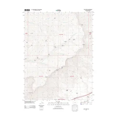
2013 Map of Anvil Points
USGS Topo · Published 2013About this map
Anvil Points defines the dramatic transition from the high Roan Plateau to the Colorado River valley floor in this western Colorado landscape. The sheer escarpment features prominent landmarks such as West Anvil Point and East Anvil Point, which overlook a complex network of drainages including First Anvil Creek and Second Anvil Creek. To the north, the plateau surface is dissected by numerous gulches and draws, from Magpie Gulch in the northeast to the remote Ben Good Creek in the west. This 2013 survey illustrates the modern configuration of access roads like Frontage Rd and Landfill Rd near the settlement at Lacy. Local history is embedded in the naming of topographical features such as Glover Park, Sharrard Park, and Goodrich Park, alongside the expansive Webster Mesa that stretches toward the southeastern corner of the quadrangle.
Find a feature on this map
45 named features on this map. Tap any name to fly to it.
Don’t see what you’re looking for? This feature index may not catch every label — zoom into the map to look around manually.
Map Details
Editions of this 2013 Anvil Points Map
This is the sole edition of this map. No revisions or reprints were ever made.
Other maps of this area

1906 · Grand Hogback
USGS Topo · 1:125,000

1910 · Grand Hogback
USGS Topo · 1:125,000

1925 · Parachute Creek
USGS Topo · 1:62,500

1927 · Parachute Creek
USGS Topo · 1:62,500

1929 · Grand Valley
USGS Topo · 1:62,500

1952 · Rio Blanco
USGS Topo · 1:24,000

1952 · Anvil Points
USGS Topo · 1:24,000

1952 · Horse Mountain
USGS Topo · 1:24,000

1952 · Rifle
USGS Topo · 1:24,000

1956 · Grand Junction
USGS Topo · 1:250,000