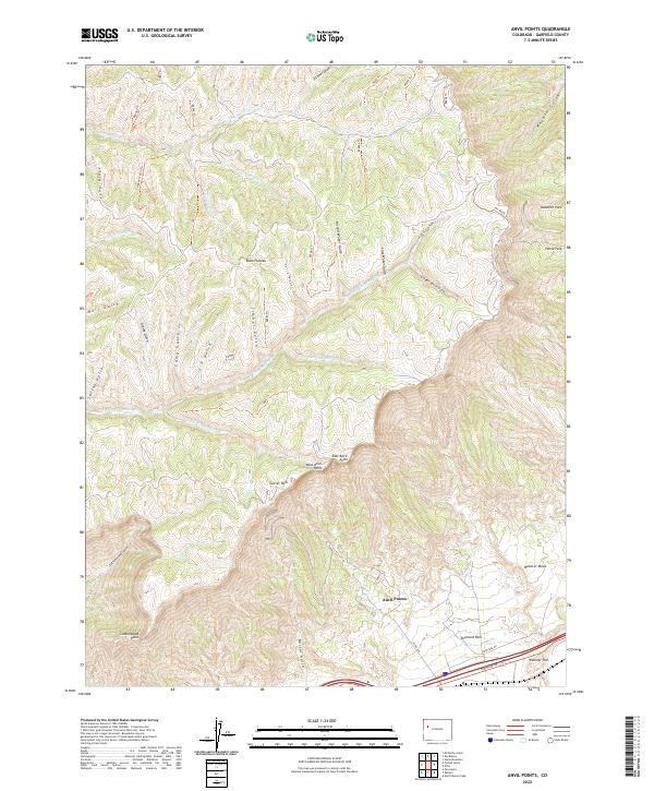
2022 Map of Anvil Points
USGS Topo · Published 2022About this map
Anvil Points stands as the defining topographic feature of this Garfield County landscape, where the high elevations of the Roan Plateau drop sharply toward the Colorado River valley. This 2022 survey captures the intricate network of drainage gulches and ridges that characterize the region, from Magpie Gulch in the northeast to the steep descent of Cottonwood Gulch. The map reveals a land utilized for both its recreational and natural resources, marked by numerous numbered trails such as 8005 Trl and historical markers like the Lindauer Cabin Trl. High-altitude flats including Glover Park, Goodrich Park, and Horse Park sit nestled between the rugged breaks. Along the southern edge, the infrastructure of Co RD 246 and a Frontage Rd follows the base of Webster Hill, illustrating the primary transportation corridor through this complex terrain.
Find a feature on this map
55 named features on this map. Tap any name to fly to it.
Don’t see what you’re looking for? This feature index may not catch every label — zoom into the map to look around manually.
Map Details
Editions of this 2022 Anvil Points Map
This is the sole edition of this map. No revisions or reprints were ever made.
Other maps of this area

1906 · Grand Hogback
USGS Topo · 1:125,000

1910 · Grand Hogback
USGS Topo · 1:125,000

1925 · Parachute Creek
USGS Topo · 1:62,500

1927 · Parachute Creek
USGS Topo · 1:62,500

1929 · Grand Valley
USGS Topo · 1:62,500

1952 · Rio Blanco
USGS Topo · 1:24,000

1952 · Anvil Points
USGS Topo · 1:24,000

1952 · Horse Mountain
USGS Topo · 1:24,000

1952 · Rifle
USGS Topo · 1:24,000

1956 · Grand Junction
USGS Topo · 1:250,000