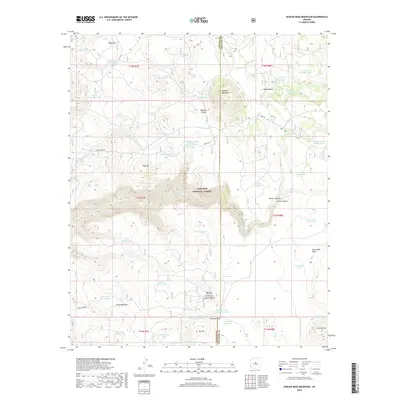
2018 Map of Apache Maid Mountain
USGS Topo · Published 2018About this map
Apache Maid Mtn rises as a central landmark within this portion of the Coconino National Forest, where the high desert terrain transitions through complex drainage systems. The landscape is defined by its water management history, evidenced by a dense network of stock tanks including the Table Mountain Tank and Bruce Place Tank, which supported ranching in this arid environment. Significant topographic features like Mullican Canyon and Jacks Canyon carve through the plateau, while the Maid Trl provides a transit route through the Yavapai and Coconino County border region. From the elevations of Oak Hill to the depths of Roundup Basin, the map illustrates a remote wilderness utilized for both its natural resources and strategic high points, such as Horse Knoll and Big Hill.
Find a feature on this map
66 named features on this map. Tap any name to fly to it.
Don’t see what you’re looking for? This feature index may not catch every label — zoom into the map to look around manually.
Map Details
Editions of this 2018 Apache Maid Mountain Map
This is the sole edition of this map. No revisions or reprints were ever made.
Other maps of this area

1887 · Verde
USGS Topo · 1:250,000

1892 · Verde
USGS Topo · 1:250,000

1923 · Camp Verde
USGS Topo · 1:125,000

1932 · Camp Verde
USGS Topo · 1:125,000

1936 · Camp Verde
USGS Topo · 1:125,000

1954 · Holbrook
USGS Topo · 1:250,000

1957 · Holbrook
USGS Topo · 1:250,000

1958 · Holbrook
USGS Topo · 1:250,000

1960 · Holbrook
USGS Topo · 1:250,000
1965 · Calloway Butte
USGS Topo · 1:24,000