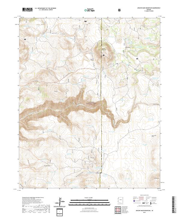
2021 Map of Apache Maid Mountain
USGS Topo · Published 2021About this map
Coconino National Forest defines the character of this high-elevation landscape, where cattle ranching and water management are written into the names of the land. The topography is deeply incised by drainages such as Mullican Canyon and Jacks Canyon, while the prominent summit of Apache Maid Mtn provides a central landmark for the region. A network of livestock tanks, including Table Mountain Tank, Maid Tank, and the T-bar Tank Number Two, indicates the essential infrastructure required for grazing in this arid environment.
Find a feature on this map
70 named features on this map. Tap any name to fly to it.
Don’t see what you’re looking for? This feature index may not catch every label — zoom into the map to look around manually.
Map Details
Editions of this 2021 Apache Maid Mountain Map
This is the sole edition of this map. No revisions or reprints were ever made.
Other maps of this area

1887 · Verde
USGS Topo · 1:250,000

1892 · Verde
USGS Topo · 1:250,000

1923 · Camp Verde
USGS Topo · 1:125,000

1932 · Camp Verde
USGS Topo · 1:125,000

1936 · Camp Verde
USGS Topo · 1:125,000

1954 · Holbrook
USGS Topo · 1:250,000

1957 · Holbrook
USGS Topo · 1:250,000

1958 · Holbrook
USGS Topo · 1:250,000

1960 · Holbrook
USGS Topo · 1:250,000
1965 · Calloway Butte
USGS Topo · 1:24,000