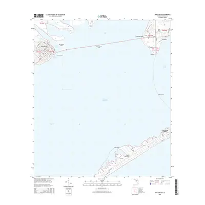
2015 Map of Apalachicola
USGS Topo · Published 2015About this map
The Apalachicola River flows into the vast Apalachicola Bay and Saint George Sound, shaping a landscape defined by its historic maritime connections. In the western reaches, the city of Apalachicola displays a grid of streets including Market St and Commerce St, which sit at the junction of Scipio Creek and the main river channel. This 2015 data reflects the area's continued reliance on the water, with the Intracoastal Waterway cutting through the bay and the John Gorrie Memorial Bridge linking the mainland to Magnolia Bluffs and Eastpoint.
Find a feature on this map
73 named features on this map. Tap any name to fly to it.
Don’t see what you’re looking for? This feature index may not catch every label — zoom into the map to look around manually.
Map Details
Editions of this 2015 Apalachicola Map
This is the sole edition of this map. No revisions or reprints were ever made.
Other maps of this area

1943 · West Pass
USGS Topo · 1:31,680

1943 · Apalachicola
USGS Topo · 1:31,680

1943 · Jackson River
USGS Topo · 1:24,000

1944 · Green Point
USGS Topo · 1:31,680

1944 · Apalachicola
USGS Topo · 1:24,000

1945 · Cape St. George
USGS Topo · 1:31,680

1945 · Beverly
USGS Topo · 1:31,680

1945 · Jackson River
USGS Topo · 1:31,680

1949 · Apalachicola
USGS Topo · 1:250,000

1950 · Goose Island
USGS Topo · 1:31,680