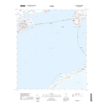
2018 Map of Apalachicola
USGS Topo · Published 2018About this map
The Apalachicola River empties into the expansive waters of the Apalachicola Bay, anchoring a landscape defined by its maritime connections and coastal geography. The town of Apalachicola serves as a focal point on the western shore, with its grid of streets including Commerce St and Broad St leading toward the Scipio Creek Channel. To the east, the community of East Point sits at the terminus of the John Gorrie Memorial Bridge, which spans the gap between the mainland and the marshy interiors of Big Towhead Island and Towhead Island. Along the southern barrier, St. George Island stretches across the horizon, featuring the St George Island Airport and the residential corridors of Gulf Beach Dr W. This 2018 survey highlights the critical role of the Intracoastal Waterway in local navigation, providing a detailed view of the shoals and points that shape this Florida Panhandle estuary.
Find a feature on this map
78 named features on this map. Tap any name to fly to it.
Don’t see what you’re looking for? This feature index may not catch every label — zoom into the map to look around manually.
Map Details
Editions of this 2018 Apalachicola Map
This is the sole edition of this map. No revisions or reprints were ever made.
Other maps of this area

1943 · West Pass
USGS Topo · 1:31,680

1943 · Apalachicola
USGS Topo · 1:31,680

1943 · Jackson River
USGS Topo · 1:24,000

1944 · Green Point
USGS Topo · 1:31,680

1944 · Apalachicola
USGS Topo · 1:24,000

1945 · Cape St. George
USGS Topo · 1:31,680

1945 · Beverly
USGS Topo · 1:31,680

1945 · Jackson River
USGS Topo · 1:31,680

1949 · Apalachicola
USGS Topo · 1:250,000

1950 · Goose Island
USGS Topo · 1:31,680