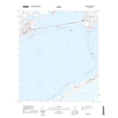
2021 Map of Apalachicola
USGS Topo · Published 2021About this map
Apalachicola serves as the focal point of this coastal survey, situated at the mouth of the Apalachicola River Blueway Trl. The map illustrates the complex maritime infrastructure required to navigate these shallow waters, featuring the Scipio Creek Channel, Two Mile Channel, and the long span of the John Gorrie Memorial Bridge connecting to East Point. The town's grid remains anchored by the Franklin County Courthouse, while the surrounding landscape is defined by the expanse of Apalachicola Bay and Saint George Sound. Further south, the barrier environment of St. George Island is detailed, showing the St. George Island Airport and the Saint George Island Trl. This modern record captures the established connection between the mainland and the islands, tracing the Intracoastal Waterway through a region shaped by both commercial fishing and recreational tourism.
Find a feature on this map
76 named features on this map. Tap any name to fly to it.
Don’t see what you’re looking for? This feature index may not catch every label — zoom into the map to look around manually.
Map Details
Editions of this 2021 Apalachicola Map
This is the sole edition of this map. No revisions or reprints were ever made.
Other maps of this area

1943 · West Pass
USGS Topo · 1:31,680

1943 · Apalachicola
USGS Topo · 1:31,680

1943 · Jackson River
USGS Topo · 1:24,000

1944 · Green Point
USGS Topo · 1:31,680

1944 · Apalachicola
USGS Topo · 1:24,000

1945 · Cape St. George
USGS Topo · 1:31,680

1945 · Beverly
USGS Topo · 1:31,680

1945 · Jackson River
USGS Topo · 1:31,680

1949 · Apalachicola
USGS Topo · 1:250,000

1950 · Goose Island
USGS Topo · 1:31,680