2023 Map of Apalachin
USGS Topo · Published 2023About this map
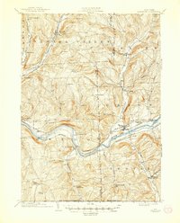
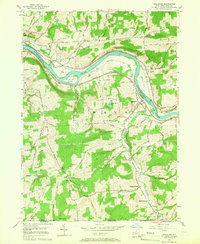
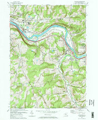
The Susquehanna River winds through Tioga County, anchoring a landscape where riverine flats and high ridges define the settlement pattern. On the northern banks, Owego and Campville follow the river's bend, while Hiawatha Island sits as a prominent landmark in the channel. The area's agricultural and rural history is etched into the hillsides through numerous family and community burial grounds, including the Riverside Cem near the riverbank and the South Owego Cem located further south near South Owego.
Find a feature on this map
109 named features on this map. Tap any name to fly to it.
Don’t see what you’re looking for? This feature index may not catch every label — zoom into the map to look around manually.
Map Details
Editions of this 2023 Apalachin Map
This is the sole edition of this map. No revisions or reprints were ever made.
Historical Maps of South Owego Through Time
5 maps found