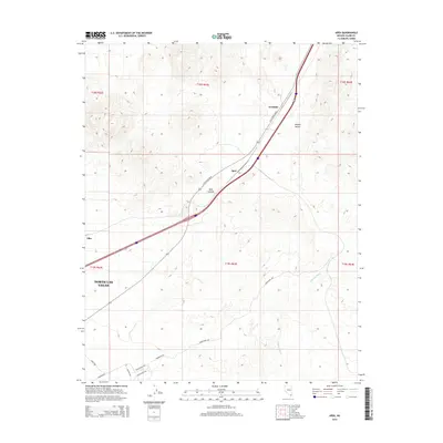
2014 Map of Apex
USGS Topo · Published 2014About this map
Apex and Arrolime occupy a pivotal high-desert corridor in the Mojave Desert northeast of the city center. This landscape is defined by the logistics of transportation and military infrastructure, where N Las Vegas Blvd and Interstate 15 climb toward the Apex Summit. The southern portion of the map transitions into the northern reaches of North Las Vegas, characterized by a strictly organized grid of service roads including Mather Ave, Malmstrom Ave, and Perimeter Rd. These routes suggest the specialized industrial or military nature of the area during the early 21st century. Natural drainage is represented by the winding path of Gypsum Wash, which cuts through the arid terrain east of the main highway, providing a stark contrast to the engineered straight lines of the surrounding road network and the small settlement at Dike.
Find a feature on this map
20 named features on this map. Tap any name to fly to it.
Don’t see what you’re looking for? This feature index may not catch every label — zoom into the map to look around manually.
Map Details
Editions of this 2014 Apex Map
This is the sole edition of this map. No revisions or reprints were ever made.
Other maps of this area

1886 · Saint Thomas
USGS Topo · 1:250,000

1893 · Saint Thomas
USGS Topo · 1:250,000

1907 · Las Vegas
USGS Topo · 1:250,000

1908 · Las Vegas
USGS Topo · 1:250,000

1926 · Boulder Canyon
USGS Topo · 1:96,000

1952 · Gass Peak
USGS Topo · 1:62,500

1952 · Dry Lake
USGS Topo · 1:62,500

1952 · Henderson
USGS Topo · 1:62,500

1952 · Las Vegas
USGS Topo · 1:62,500

1954 · Las Vegas
USGS Topo · 1:250,000