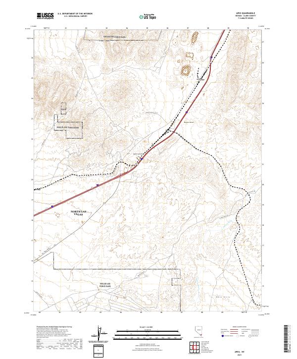
2021 Map of Apex
USGS Topo · Published 2021About this map
Apex and the adjacent industrial site of Arrolime occupy a prominent position along the transportation corridors northeast of North Las Vegas. This high-desert landscape is defined by the Mojave Desert terrain, where the elevation rises toward Apex Summit. The map documents a critical junction of modern infrastructure and historical routes, including the Old Spanish Trail Rd and Las Vegas Blvd N, cutting through the dry landscape of the Gale Hills. Drainage patterns are marked by Gypsum Wash, which carries seasonal runoff across the arid flats. The arrangement of settlements like Dike and the network of heavy-duty thoroughfares such as Nadine Petersen Blvd reflect the area's development as an industrial and logistical hub for the Las Vegas valley.
Find a feature on this map
19 named features on this map. Tap any name to fly to it.
Don’t see what you’re looking for? This feature index may not catch every label — zoom into the map to look around manually.
Map Details
Editions of this 2021 Apex Map
This is the sole edition of this map. No revisions or reprints were ever made.
Other maps of this area

1886 · Saint Thomas
USGS Topo · 1:250,000

1893 · Saint Thomas
USGS Topo · 1:250,000

1907 · Las Vegas
USGS Topo · 1:250,000

1908 · Las Vegas
USGS Topo · 1:250,000

1926 · Boulder Canyon
USGS Topo · 1:96,000

1952 · Gass Peak
USGS Topo · 1:62,500

1952 · Dry Lake
USGS Topo · 1:62,500

1952 · Henderson
USGS Topo · 1:62,500

1952 · Las Vegas
USGS Topo · 1:62,500

1954 · Las Vegas
USGS Topo · 1:250,000