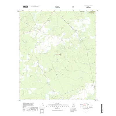
2019 Map of Apple Springs
USGS Topo · Published 2019About this map
Davy Crockett National Forest dominates the topography of this East Texas region, where dense timber and creek bottoms define the rural landscape. Small communities like Helmic and Nigton are connected by a network of farm-to-market roads and forest service tracks, including FM 357 and FM 2262. For genealogists, the Mount Zion Cem serves as a critical landmark near Crib Cr. The northeastern corner of the map reveals the complex hydrology of the Neches River basin, featuring Old River Island, Viney Bend, and Faglea Lake along the boundary between Trinity and Angelina counties. This area is characterized by slow-moving waterways such as Alabama Cr and Forsythe Cr that wind through the protected woodland, illustrating the persistence of timber-based land use in the Piney Woods.
Find a feature on this map
50 named features on this map. Tap any name to fly to it.
Don’t see what you’re looking for? This feature index may not catch every label — zoom into the map to look around manually.
Map Details
Editions of this 2019 Apple Springs Map
This is the sole edition of this map. No revisions or reprints were ever made.
Other maps of this area

1949 · Keltys
USGS Topo · 1:24,000

1950 · Keltys
USGS Topo · 1:24,000

1950 · Centralia
USGS Topo · 1:24,000

1951 · Wells SW
USGS Topo · 1:24,000

1951 · Centralia
USGS Topo · 1:24,000

1953 · Palestine
USGS Topo · 1:250,000

1957 · Palestine
USGS Topo · 1:250,000

1963 · Crecy
USGS Topo · 1:24,000

1963 · Groveton East
USGS Topo · 1:24,000
1963 · Apple Springs
USGS Topo · 1:24,000