
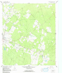
1963 Map of Groveton East
USGS Topo · Published 1964About this map
Davy Crockett National Forest dominates this East Texas landscape, where the wooded terrain is carved by the winding paths of Piney Creek and Caney Creek. In the early 1960s, the area retained a strong rural character defined by small timber-adjacent communities and scattered country churches. The eastern edge of Groveton is visible, linked by the prominent Main Street corridor to nearby settlements like Josserand and Woodlake.
Find a feature on this map
31 named features on this map. Tap any name to fly to it.
Don’t see what you’re looking for? This feature index may not catch every label — zoom into the map to look around manually.
Map Details
Editions of this 1963 Groveton East Map
2 editions found
Other maps of this area

1953 · Palestine
USGS Topo · 1:250,000

1954 · Beaumont
USGS Topo · 1:250,000

1955 · New Willard
USGS Topo · 1:62,500

1957 · Beaumont
USGS Topo · 1:250,000

1957 · Palestine
USGS Topo · 1:250,000

1960 · Colita
USGS Topo · 1:24,000

1963 · Crecy
USGS Topo · 1:24,000

1963 · Groveton West
USGS Topo · 1:24,000
1963 · Pennington
USGS Topo · 1:24,000
1963 · Apple Springs
USGS Topo · 1:24,000