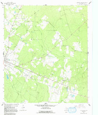
1963 Map of Groveton East
USGS Topo · Published 1992About this map
Davy Crockett National Forest dominates much of this Trinity County landscape, where the creek systems of Piney Creek and Kickapoo Creek define the local topography. This 1963 survey captures the area at a time when the Old Railroad Grade remained a prominent geographic marker across the timberlands. The settlement patterns are anchored by Groveton and Woodlake, with smaller communities and rural life represented by landmarks such as Mt Olive Ch and St Paul Ch.
Find a feature on this map
31 named features on this map. Tap any name to fly to it.
Don’t see what you’re looking for? This feature index may not catch every label — zoom into the map to look around manually.
Map Details
Editions of this 1963 Groveton East Map
2 editions found
Other maps of this area

1953 · Palestine
USGS Topo · 1:250,000

1954 · Beaumont
USGS Topo · 1:250,000

1955 · New Willard
USGS Topo · 1:62,500

1957 · Beaumont
USGS Topo · 1:250,000

1957 · Palestine
USGS Topo · 1:250,000

1960 · Colita
USGS Topo · 1:24,000

1963 · Crecy
USGS Topo · 1:24,000

1963 · Groveton West
USGS Topo · 1:24,000
1963 · Pennington
USGS Topo · 1:24,000

1963 · Groveton East
USGS Topo · 1:24,000