
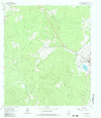
1963 Map of Groveton West
USGS Topo · Published 1964About this map
Westville and the western outskirts of Groveton anchor this landscape during a period when the timber industry and land management were well established in East Texas. Much of the area is enveloped by the Davy Crockett National Forest, where the topography is defined by the drainages of Caney Creek, White Oak Creek, and Fountain Creek. A notable information-gain detail is the Old Railroad Grade running through the northeastern sector, a quiet reminder of the extensive logging rail networks that once moved pine across Trinity County.
Find a feature on this map
20 named features on this map. Tap any name to fly to it.
Don’t see what you’re looking for? This feature index may not catch every label — zoom into the map to look around manually.
Map Details
Editions of this 1963 Groveton West Map
2 editions found
Other maps of this area

1953 · Palestine
USGS Topo · 1:250,000

1954 · Beaumont
USGS Topo · 1:250,000

1957 · Beaumont
USGS Topo · 1:250,000

1957 · Palestine
USGS Topo · 1:250,000

1960 · Colita
USGS Topo · 1:24,000

1960 · Trinity East
USGS Topo · 1:24,000

1962 · Glendale
USGS Topo · 1:24,000

1963 · Crecy
USGS Topo · 1:24,000
1963 · Pennington
USGS Topo · 1:24,000

1963 · Groveton East
USGS Topo · 1:24,000