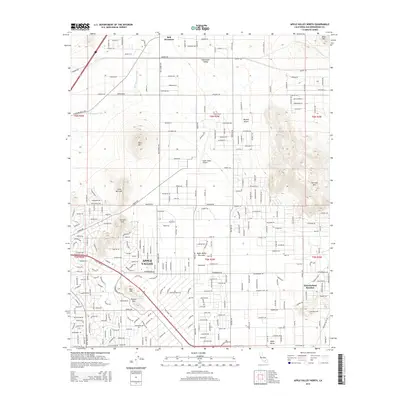
2015 Map of Apple Valley North
USGS Topo · Published 2015About this map
Bell Mountain and the surrounding high desert topography dominate this 2015 survey of the northern reaches of the Apple Valley community. The map reveals a transition from the structured residential blocks and the Apple Valley Airport in the south to the more open, arid expanses of the Mojave Desert and Sidewinder Valley to the north. Distinctive landmarks such as Catholic Hill, Pioneer Mtn, and the ephemeral Apple Valley Dry Lake suggest a landscape where modern development meets traditional desert ranching and recreation.
Find a feature on this map
237 named features on this map. Tap any name to fly to it.
Don’t see what you’re looking for? This feature index may not catch every label — zoom into the map to look around manually.
Map Details
Editions of this 2015 Apple Valley North Map
This is the sole edition of this map. No revisions or reprints were ever made.
Other maps of this area

1901 · Southern California Sheet No. 1
USGS Topo · 1:250,000

1902 · Deep Creek
USGS Topo · 1:62,500

1902 · Hesperia
USGS Topo · 1:62,500

1904 · Southern California Sheet No. 1
USGS Topo · 1:250,000

1932 · Barstow
USGS Topo · 1:125,000

1934 · Barstow
USGS Topo · 1:125,000

1942 · Hesperia
USGS Topo · 1:62,500

1953 · San Bernardino
USGS Topo · 1:250,000

1956 · San Bernardino
USGS Topo · 1:250,000
1956 · Hesperia
USGS Topo · 1:24,000
Featured Places
- Apple Valley, CA
- Bell Mountain, Apple Valley
- Desert Knolls Manor, Apple Valley
- San Bernardino County, CA
- United States