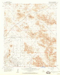
1957 Map of Apple Valley
USGS Topo · Published 1960About this map
Apple Valley is shown during a period of mid-century desert development, with a street grid beginning to take shape around Waalew Road and Cahuilla Road. The town's early infrastructure is anchored by the Apple Valley Country Club and a local Airport, reflecting its growth as a residential and recreational destination. Beyond the emerging residential core, the landscape remains dominated by rugged mining and desert operations.
Find a feature on this map
49 named features on this map. Tap any name to fly to it.
Don’t see what you’re looking for? This feature index may not catch every label — zoom into the map to look around manually.
Map Details
Editions of this 1957 Apple Valley Map
3 editions found

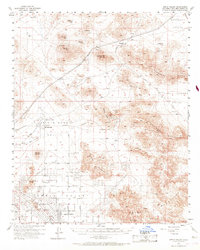
Other maps of this area

1901 · Southern California Sheet No. 1
USGS Topo · 1:250,000

1902 · Deep Creek
USGS Topo · 1:62,500

1902 · Hesperia
USGS Topo · 1:62,500

1902 · San Gorgonio
USGS Topo · 1:125,000

1904 · Southern California Sheet No. 1
USGS Topo · 1:250,000

1932 · Barstow
USGS Topo · 1:125,000

1934 · Barstow
USGS Topo · 1:125,000

1942 · Hesperia
USGS Topo · 1:62,500

1947 · Lucerne Valley
USGS Topo · 1:62,500

1949 · Lucerne Valley
USGS Topo · 1:62,500
Featured Places
- Apple Valley, CA
- Desert Knolls Manor, Apple Valley
- Thunderbird Ranches, CA
- Bell Mountain, Apple Valley
- Lucerne Valley, CA