
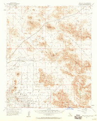
1957 Map of Apple Valley
USGS Topo · Published 1957About this map
Apple Valley sits at a crossroads of mid-century suburban expansion and industrial mining history. This 1957 survey captures the town's early residential grid, characterized by major thoroughfares like Central Road and Navajo Rd, alongside leisure developments such as the Apple Valley Country Club. The surrounding landscape is dominated by heavy resource extraction, evidenced by the Sidewinder Mining Railroad which serviced the interior desert valleys. To the north and east, the terrain rises into the Granite Mountains and Fairview Mountain, where scattered industrial sites like the Sidewinder Mine, Red Top Mine, and Altuda Mine mark the high ground. The map details a transition from organized town streets to the vast, open expanses of Stoddard Valley and North Lucerne Valley, showing a region where the Mojave's natural topography still dictated the pace of development.
Find a feature on this map
52 named features on this map. Tap any name to fly to it.
Don’t see what you’re looking for? This feature index may not catch every label — zoom into the map to look around manually.
Map Details
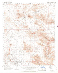
Editions of this 1957 Apple Valley Map
3 editions found
Other maps of this area

1901 · Southern California Sheet No. 1
USGS Topo · 1:250,000

1902 · Deep Creek
USGS Topo · 1:62,500

1902 · Hesperia
USGS Topo · 1:62,500

1902 · San Gorgonio
USGS Topo · 1:125,000

1904 · Southern California Sheet No. 1
USGS Topo · 1:250,000

1932 · Barstow
USGS Topo · 1:125,000

1934 · Barstow
USGS Topo · 1:125,000

1942 · Hesperia
USGS Topo · 1:62,500

1947 · Lucerne Valley
USGS Topo · 1:62,500

1949 · Lucerne Valley
USGS Topo · 1:62,500
Featured Places
- Apple Valley, CA
- Desert Knolls Manor, Apple Valley
- Thunderbird Ranches, CA
- Bell Mountain, Apple Valley
- Lucerne Valley, CA