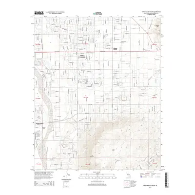
2015 Map of Apple Valley South
USGS Topo · Published 2015About this map
Apple Valley and Hesperia occupy the center of this high-desert landscape in the mid-2010s, showing a transition from dense residential grids to the wide-open spaces of the San Bernardino high desert. The northern half of the map is defined by a rhythmic street layout, featuring thoroughfares like Bear Valley Rd and Tussing Ranch Rd, alongside smaller intersections like Cotners Corner. This development pushes right to the edge of the Antelope Valley area.
Find a feature on this map
96 named features on this map. Tap any name to fly to it.
Don’t see what you’re looking for? This feature index may not catch every label — zoom into the map to look around manually.
Map Details
Editions of this 2015 Apple Valley South Map
This is the sole edition of this map. No revisions or reprints were ever made.
Other maps of this area

1901 · Southern California Sheet No. 1
USGS Topo · 1:250,000

1902 · Deep Creek
USGS Topo · 1:62,500

1902 · Hesperia
USGS Topo · 1:62,500

1904 · Southern California Sheet No. 1
USGS Topo · 1:250,000

1932 · Barstow
USGS Topo · 1:125,000

1934 · Barstow
USGS Topo · 1:125,000

1942 · Hesperia
USGS Topo · 1:62,500

1953 · San Bernardino
USGS Topo · 1:250,000

1956 · San Bernardino
USGS Topo · 1:250,000
1956 · Hesperia
USGS Topo · 1:24,000