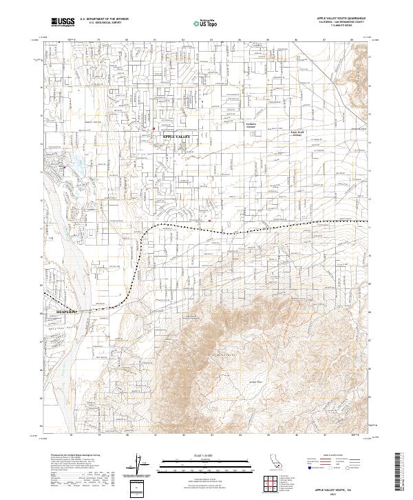
2021 Map of Apple Valley South
USGS Topo · Published 2021About this map
Apple Valley and Hesperia occupy the northwestern basin of this map, showcasing the significant residential expansion and suburban street grids that characterize this portion of the High Desert. The map captures the transition from the structured neighborhoods of Antelope Valley to the more varied desert terrain of the Ord Mountains and the extensive Juniper Flats to the south. Historically unique sites such as Lone Wolf Colony and Cotners Corner appear as notable nodes within the expansive network of named local roads.
Find a feature on this map
149 named features on this map. Tap any name to fly to it.
Don’t see what you’re looking for? This feature index may not catch every label — zoom into the map to look around manually.
Map Details
Editions of this 2021 Apple Valley South Map
This is the sole edition of this map. No revisions or reprints were ever made.
Other maps of this area

1901 · Southern California Sheet No. 1
USGS Topo · 1:250,000

1902 · Deep Creek
USGS Topo · 1:62,500

1902 · Hesperia
USGS Topo · 1:62,500

1904 · Southern California Sheet No. 1
USGS Topo · 1:250,000

1932 · Barstow
USGS Topo · 1:125,000

1934 · Barstow
USGS Topo · 1:125,000

1942 · Hesperia
USGS Topo · 1:62,500

1953 · San Bernardino
USGS Topo · 1:250,000

1956 · San Bernardino
USGS Topo · 1:250,000
1956 · Hesperia
USGS Topo · 1:24,000
Featured Places
- Hesperia, CA
- Apple Valley, CA
- Apple Valley Highlands, CA
- Cotners Corner, Apple Valley
- Lone Wolf Colony, Apple Valley