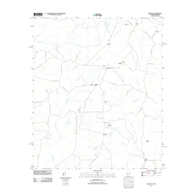
2011 Map of Aquilla
USGS Topo · Published 2011About this map
Turkey Creek and Red Creek carve through this corner of Choctaw County, shaping a landscape defined by small rural settlements and resource extraction. The community of Aquilla serves as a central point, flanked by the Zion Chapel Oil Field to the north and the Healing Springs Gas Field near Shady Grove to the south. For genealogists, the map is particularly dense with burial sites, including the Old Aquilla Cemetery, Wilkins Cemetery, and Mount Zion Cemetery. Transportation follows established corridors like Co Hwy 2 and Co Hwy 3, which connect the scattered hamlets of Contwell and Chapel Hill. Small bodies of water such as Lake Gypsy and Lake Ola dot the interior, while the Aquilla Lookout Tower stands as a prominent local landmark overlooking the drainage basins of Whiskey Creek and Sandy Creek.
Find a feature on this map
61 named features on this map. Tap any name to fly to it.
Don’t see what you’re looking for? This feature index may not catch every label — zoom into the map to look around manually.
Map Details
Editions of this 2011 Aquilla Map
This is the sole edition of this map. No revisions or reprints were ever made.
Other maps of this area

1953 · Hattiesburg
USGS Topo · 1:250,000

1958 · Hattiesburg
USGS Topo · 1:250,000

1964 · Denham
USGS Topo · 1:24,000

1964 · Buckatunna
USGS Topo · 1:24,000

1964 · Matherville
USGS Topo · 1:24,000

1974 · Millry South
USGS Topo · 1:24,000

1974 · Millry North
USGS Topo · 1:24,000

1974 · Silas
USGS Topo · 1:24,000

1974 · Copeland
USGS Topo · 1:24,000

1974 · Isney
USGS Topo · 1:24,000