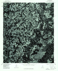
1975 Map of Arab
USGS Topo · Published 1977About this map
Arab and the surrounding Marshall County countryside are captured here in high-contrast detail, revealing a mid-1970s landscape defined by an intricate network of rural roads and agricultural clearings. As an orthophotograph produced from 1975 aerial photography, the map bypasses traditional topographic contour lines to show the literal texture of the earth, from the dense woodland along the eastern bluffs to the patchwork fields of the plateaus. The town of Arab shows significant development along its primary corridors, while smaller outlying settlements like Scant City and Red Hill anchor the agricultural hinterlands. To the east, the sprawling waters of Guntersville Lake appear as a dark, branching contrast to the upland terrain, illustrating how the Tennessee River Valley topography transitions into the higher elevations of this region.
Find a feature on this map
4 named features on this map. Tap any name to fly to it.
Don’t see what you’re looking for? This feature index may not catch every label — zoom into the map to look around manually.
Map Details
Editions of this 1975 Arab Map
2 editions found
Other maps of this area

1885 · Gadsden
USGS Topo · 1:125,000

1888 · Cullman
USGS Topo · 1:125,000

1888 · Gadsden
USGS Topo · 1:125,000

1892 · Cullman
USGS Topo · 1:125,000

1892 · Gadsden
USGS Topo · 1:125,000

1895 · Gadsden
USGS Topo · 1:125,000

1903 · Gadsden
USGS Topo · 1:125,000

1936 · Guntersville
USGS Topo · 1:24,000

1936 · Guntersville Dam
USGS Topo · 1:24,000

1936 · Hulaco
USGS Topo · 1:24,000