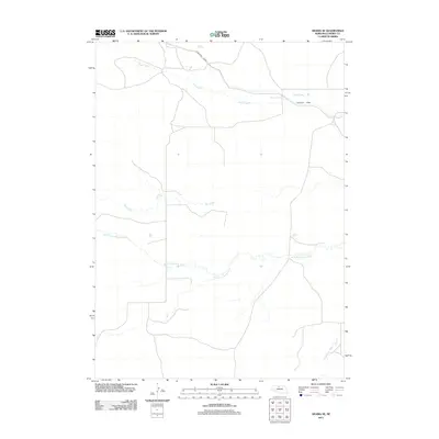
2011 Map of Arabia SE
USGS Topo · Published 2011About this map
The Ainsworth Canal cuts across the northern landscape of Cherry County, representing the vital irrigation infrastructure of the Nebraska Sandhills. This 2011 survey illustrates a region defined by its water management and drainage patterns, where the complex hydrology of the North Fork Plum Creek and South Fork Plum Creek winds through the grasslands. These intermittent and perennial flows, including Rush Creek and Dry Creek, highlight the seasonal nature of the local environment. The sparse road network and absence of concentrated settlements underscore the ranching character of this expansive terrain, showing how land use is dictated by the natural placement of water bodies and the artificial channels designed to redirect them. It is a detailed look at the rural connectivity and hydrographic features of the Nebraska plains during the early twenty-first century.
Find a feature on this map
5 named features on this map. Tap any name to fly to it.
Don’t see what you’re looking for? This feature index may not catch every label — zoom into the map to look around manually.
Map Details
Editions of this 2011 Arabia SE Map
This is the sole edition of this map. No revisions or reprints were ever made.
Other maps of this area

1949 · Long Lake
USGS Topo · 1:62,500

1950 · Wood Lake
USGS Topo · 1:62,500

1950 · Arabia
USGS Topo · 1:62,500

1951 · Long Lake
USGS Topo · 1:62,500

1951 · Moon Lake
USGS Topo · 1:62,500

1957 · Valentine
USGS Topo · 1:250,000

1959 · Valentine
USGS Topo · 1:250,000

1985 · Long Lake
USGS Topo · 1:24,000

1985 · Wilson Valley
USGS Topo · 1:24,000
1985 · Brush Creek
USGS Topo · 1:24,000