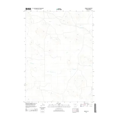
2014 Map of Arabia SE
USGS Topo · Published 2014About this map
Ainsworth Canal cuts across the northern section of this landscape in eastern Cherry County, a critical piece of water infrastructure that defines the local agricultural potential. This 2014 survey documents a sparse, creek-fed terrain where the hydrology is dominated by the N Fork Plum Cr and the S Fork Plum Cr. The drainage patterns of Rush Cr and Dry Cr illustrate the subtle topography of the Nebraska Sandhills region. Primarily composed of open rangeland and private holdings, the area maintains a strictly rural character with few structural developments, centered instead on the management of its water resources for ranching and irrigation.
Find a feature on this map
5 named features on this map. Tap any name to fly to it.
Don’t see what you’re looking for? This feature index may not catch every label — zoom into the map to look around manually.
Map Details
Editions of this 2014 Arabia SE Map
This is the sole edition of this map. No revisions or reprints were ever made.
Other maps of this area

1949 · Long Lake
USGS Topo · 1:62,500

1950 · Wood Lake
USGS Topo · 1:62,500

1950 · Arabia
USGS Topo · 1:62,500

1951 · Long Lake
USGS Topo · 1:62,500

1951 · Moon Lake
USGS Topo · 1:62,500

1957 · Valentine
USGS Topo · 1:250,000

1959 · Valentine
USGS Topo · 1:250,000

1985 · Long Lake
USGS Topo · 1:24,000

1985 · Wilson Valley
USGS Topo · 1:24,000
1985 · Brush Creek
USGS Topo · 1:24,000