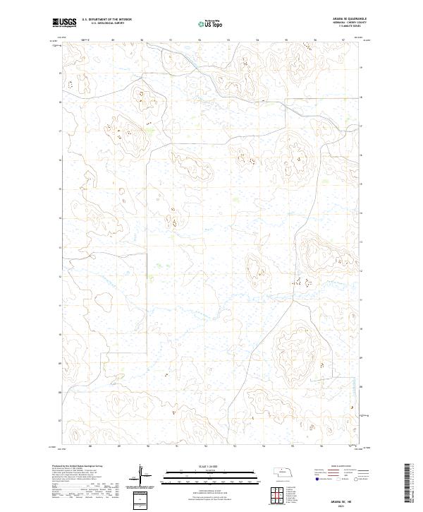
2021 Map of Arabia SE
USGS Topo · Published 2021About this map
The Ainsworth Canal cuts across the northern edge of this Sandhills landscape, representing a vital piece of water management infrastructure in north-central Nebraska. This 2021 survey of the Arabia SE area highlights a terrain defined by subtle drainage patterns and seasonal watercourses. The network of intermittent flows includes the N Fork Plum Cr and the S Fork Plum Cr, which trace the low-lying reaches of the county. Smaller tributaries like Rush Cr and Dry Cr further illustrate the hydrologic character of the region, where land use is dictated by the availability of water and the undulating elevations of the dunes. The map provides a clear look at the sparse, open nature of this part of Cherry County, dominated by the township and range grids of t30n r26w and t31n r25w.
Find a feature on this map
11 named features on this map. Tap any name to fly to it.
Don’t see what you’re looking for? This feature index may not catch every label — zoom into the map to look around manually.
Map Details
Editions of this 2021 Arabia SE Map
This is the sole edition of this map. No revisions or reprints were ever made.
Other maps of this area

1949 · Long Lake
USGS Topo · 1:62,500

1950 · Wood Lake
USGS Topo · 1:62,500

1950 · Arabia
USGS Topo · 1:62,500

1951 · Long Lake
USGS Topo · 1:62,500

1951 · Moon Lake
USGS Topo · 1:62,500

1957 · Valentine
USGS Topo · 1:250,000

1959 · Valentine
USGS Topo · 1:250,000

1985 · Long Lake
USGS Topo · 1:24,000

1985 · Wilson Valley
USGS Topo · 1:24,000
1985 · Brush Creek
USGS Topo · 1:24,000