
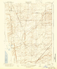
1911 Map of Arcade
USGS Topo · Published 1911About this map
Del Paso and the surrounding plains north of Sacramento are defined by an expanding network of early twentieth-century infrastructure. Surveyed by T. H. Moncure and M. A. Knock, this map illustrates a landscape transitioning from open ranch land toward a series of rail-oriented settlements. Three major rail lines—the Northern Electric, Western Pacific, and Southern Pacific—cut diagonal swaths across the territory, fueling the growth of small hubs like Elverta, Robla, and Arcade.
Find a feature on this map
21 named features on this map. Tap any name to fly to it.
Don’t see what you’re looking for? This feature index may not catch every label — zoom into the map to look around manually.
Map Details
Editions of this 1911 Arcade Map
2 editions found
Other maps of this area

1891 · Sacramento
USGS Topo · 1:125,000

1892 · Sacramento
USGS Topo · 1:125,000

1893 · Sacramento
USGS Topo · 1:125,000

1902 · Fairoaks
USGS Topo · 1:62,500

1907 · Davisville
USGS Topo · 1:62,500

1910 · Roseville
USGS Topo · 1:31,680

1910 · Vernon
USGS Topo · 1:31,680

1910 · Pleasant Grove
USGS Topo · 1:31,680

1911 · Brighton
USGS Topo · 1:31,680

1911 · Mills
USGS Topo · 1:31,680