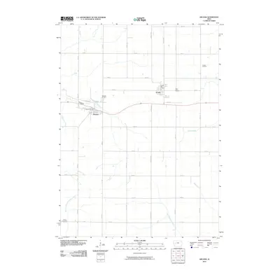
2010 Map of Arcadia
USGS Topo · Published 2010About this map
Arcadia and Westside anchor this Carroll County landscape, positioned along a prominent drainage divide. The terrain is defined by the headwaters of several key watercourses, including the East Boyer River flowing toward the Missouri and the West Nishnabotna River which originates in the southwestern portion of the quadrangle. This 2010 survey illustrates a highly organized agricultural grid, with arterial routes like Concord Ave and Delta Ave intersecting east-west roads such as 180th St. Local history and genealogy researchers will find several well-defined burial grounds across the townships, including Arcadia Cemetery, Saint Johns Cemetery, and Hayes Township Cemetery. The civic centers of these small communities remain focused around the Arcadia Post Office and Westside Post Office, which serve as the primary landmarks within the residential clusters. Smaller tributaries like Brushy Creek and Halbur Creek further dissect the rolling farmland, marking the natural contours of the Iowa prairie.
Find a feature on this map
38 named features on this map. Tap any name to fly to it.
Don’t see what you’re looking for? This feature index may not catch every label — zoom into the map to look around manually.
Map Details
Editions of this 2010 Arcadia Map
This is the sole edition of this map. No revisions or reprints were ever made.
Other maps of this area

1954 · Omaha
USGS Topo · 1:250,000

1954 · Fort Dodge
USGS Topo · 1:250,000

1957 · Omaha
USGS Topo · 1:250,000

1957 · Fort Dodge
USGS Topo · 1:250,000

1958 · Omaha
USGS Topo · 1:250,000

1958 · Fort Dodge
USGS Topo · 1:250,000

1971 · Templeton
USGS Topo · 1:24,000

1978 · Manilla
USGS Topo · 1:24,000

1978 · Manning
USGS Topo · 1:24,000

1980 · Breda
USGS Topo · 1:24,000