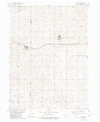
1980 Map of Arcadia
USGS Topo · Published 1980About this map
The Chicago and North Western railroad forms a vital corridor across the agricultural landscape of western Iowa, connecting the towns of Arcadia and Westside. This 1980 edition reveals the structured layout of these rural communities, where the rail line dictates the orientation of streets and local infrastructure, including the Hoffman Park area. The topographic detail captures the divide between the Boyer River and the headwaters of the West Nishnabotna River, illustrating the rolling drainage patterns that define this part of the state.
Find a feature on this map
17 named features on this map. Tap any name to fly to it.
Don’t see what you’re looking for? This feature index may not catch every label — zoom into the map to look around manually.
Map Details
Editions of this 1980 Arcadia Map
This is the sole edition of this map. No revisions or reprints were ever made.
Other maps of this area

1954 · Omaha
USGS Topo · 1:250,000

1954 · Fort Dodge
USGS Topo · 1:250,000

1957 · Omaha
USGS Topo · 1:250,000

1957 · Fort Dodge
USGS Topo · 1:250,000

1958 · Omaha
USGS Topo · 1:250,000

1958 · Fort Dodge
USGS Topo · 1:250,000

1971 · Templeton
USGS Topo · 1:24,000

1978 · Manilla
USGS Topo · 1:24,000

1978 · Manning
USGS Topo · 1:24,000

1980 · Breda
USGS Topo · 1:24,000