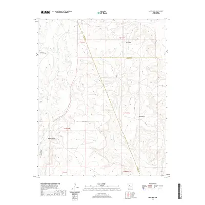
2020 Map of Arch Mesa
USGS Topo · Published 2020About this map
Arch Mesa and Herrera Mesa dominate this high-desert landscape in the Eastern Navajo Agency, where complex drainage systems like Cañada de San Antonio and Cañada los Apaches carve through the plateau. This 2020 survey reveals a quiet, open region defined by long-standing ranching and tribal connections, anchored by the settlement of Piedra Lumbre in the southwest. A critical convergence of county boundaries occurs here, as the lines for Sandoval, Cibola, and Bernalillo counties meet amidst the mesas. The network of unimproved roads, including Laguna Tribal Rd and Lobo Ranch Mgr Rd, indicates a sparsely populated area where water sources like Jose Manuel Spring and features such as Standing Rock remain vital landmarks for navigation and local history.
Find a feature on this map
26 named features on this map. Tap any name to fly to it.
Don’t see what you’re looking for? This feature index may not catch every label — zoom into the map to look around manually.
Map Details
Editions of this 2020 Arch Mesa Map
This is the sole edition of this map. No revisions or reprints were ever made.
Other maps of this area

1883 · Mt. Taylor
USGS Topo · 1:250,000

1886 · Mt. Taylor
USGS Topo · 1:250,000

1892 · Mt. Taylor
USGS Topo · 1:250,000

1899 · Mt. Taylor
USGS Topo · 1:250,000

1954 · Herrera
USGS Topo · 1:24,000

1954 · Canoncito School
USGS Topo · 1:24,000
1957 · Mesa Gigante
USGS Topo · 1:24,000

1957 · Moquino
USGS Topo · 1:24,000

1957 · Mesita
USGS Topo · 1:24,000
1957 · Arch Mesa
USGS Topo · 1:24,000