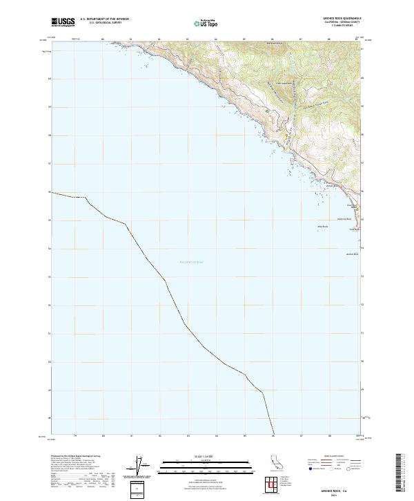
2021 Map of Arched Rock
USGS Topo · Published 2021About this map
Black Mtn Ridge and Little Black Mtn dominate the high ground of the Sonoma coast, where the Pacific shoreline meets a complex system of coastal drainages. The topography is defined by the steep descent of gulches toward the sea, including Russian Gulch and its several branches, alongside Meyer Gulch and Jewell Gulch. These waterways carve through the landscape, creating a series of ridges and headlands that terminate at the water's edge.
Find a feature on this map
24 named features on this map. Tap any name to fly to it.
Don’t see what you’re looking for? This feature index may not catch every label — zoom into the map to look around manually.
Map Details
Editions of this 2021 Arched Rock Map
This is the sole edition of this map. No revisions or reprints were ever made.
Other maps of this area

1921 · Skaggs
USGS Topo · 1:62,500

1921 · Plantation
USGS Topo · 1:62,500

1942 · Bodega Head
USGS Topo · 1:24,000

1942 · Arched Rock
USGS Topo · 1:24,000

1943 · Plantation
USGS Topo · 1:24,000

1943 · Cazadero
USGS Topo · 1:24,000

1943 · Duncans Mills
USGS Topo · 1:24,000

1943 · Fort Ross
USGS Topo · 1:24,000
1944 · Fort Ross
USGS Topo · 1:31,680
1944 · Plantation
USGS Topo · 1:31,680