
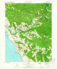
1943 Map of Duncans Mills
USGS Topo · Published 1956About this map
The Russian River winds through a complex series of bends and coastal canyons in this early 1940s survey of western Sonoma County. This era captures a landscape of seasonal camps and established riverside communities, where Duncans Mills and Monte Rio serve as focal points for the winding rail and road corridors of the canyon floor. The transition from the inland redwood forests to the Pacific coastline is marked by a series of prominent coastal features, including Penny Island at the river's mouth and the distinctive Arched Rock. Rural life in the surrounding uplands is anchored by family-named landmarks like Little Buckhorn Ranch and educational outposts such as Ocean District Sch. The map preserves the exact placement of local infrastructure before modern development, detailing individual structures and secondary roads like Coleman Valley Road that connected these coastal ridges.
Find a feature on this map
75 named features on this map. Tap any name to fly to it.
Don’t see what you’re looking for? This feature index may not catch every label — zoom into the map to look around manually.
Map Details
Editions of this 1943 Duncans Mills Map
2 editions found
Other maps of this area

1920 · Healdsburg
USGS Topo · 1:62,500

1921 · Skaggs
USGS Topo · 1:62,500

1933 · Healdsburg
USGS Topo · 1:48,000

1935 · Sebastopol
USGS Topo · 1:48,000

1940 · Healdsburg
USGS Topo · 1:62,500

1942 · Sebastopol
USGS Topo · 1:62,500

1942 · Bodega Head
USGS Topo · 1:24,000

1942 · Arched Rock
USGS Topo · 1:24,000

1943 · Cazadero
USGS Topo · 1:24,000

1943 · Fort Ross
USGS Topo · 1:24,000