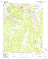
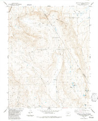
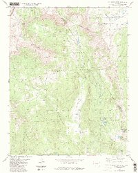
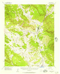
1984 Map of Archuleta Creek
USGS Topo · Published 1984About this map
The Continental Divide defines the western edge of this 1980s landscape, marking the high-altitude boundary between Archuleta Co and Conejos Co. The terrain is characterized by a complex network of high-country water sources, including the headwaters of the Rio Chama and its tributary, Archuleta Creek. Numerous alpine basins hold remote bodies of water like Chama Lake, Mystery Lake, and the Glacier Lakes cluster. The map also delineates the Grant Boundary, reflecting the historic land divisions of the Tierra Amarilla region. These mountain valleys are largely protected within the South San Juan Wilderness and the Rio Grande National Forest. Movement through this high-elevation wilderness is dictated by a system of established Pack Trails, connecting isolated points like the Campground along the river and the northern La Manga area.
Find a feature on this map
28 named features on this map. Tap any name to fly to it.
Don’t see what you’re looking for? This feature index may not catch every label — zoom into the map to look around manually.
Map Details
Editions of this 1984 Archuleta Creek Map
3 editions found
Other maps of this area

1913 · Summitville
USGS Topo · 1:125,000

1915 · Summitville
USGS Topo · 1:125,000

1918 · Tusas
USGS Topo · 1:125,000
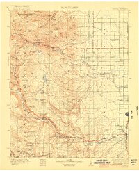
1922 · Conejos
USGS Topo · 1:125,000

1945 · Durango
USGS Topo · 1:250,000

1953 · Durango
USGS Topo · 1:250,000

1954 · Durango
USGS Topo · 1:250,000

1954 · Aztec
USGS Topo · 1:250,000
1955 · Chama
USGS Topo · 1:62,500
1955 · Brazos Peak
USGS Topo · 1:62,500