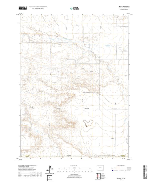
2021 Map of Arcola
USGS Topo · Published 2021About this map
Arcola sits at the heart of this high plains landscape on the border of Wyoming and Colorado, where the transition from Laramie County to Weld County is marked by a network of rural routes and waterway diversions. The topography is defined by the drainage systems of Crow Cr and Porter Cr, alongside irrigation infrastructure like the Beaver Dam Ditch and Beaver Dam Reservoir. The naming conventions of the local road network, such as Whiskey River RD, Wagon Wh, and Buffalo Grass Trl, evoke the region's ranching and frontier character. To the south, the terrain drops toward Bull Canyon near the state line, while Chalk Bluff Rd traverses the southern reaches of the quadrangle. This 2021 survey illustrates a sparse but deliberate settlement pattern, where the landscape remains dominated by open rangeland and the critical management of water in an arid environment.
Find a feature on this map
38 named features on this map. Tap any name to fly to it.
Don’t see what you’re looking for? This feature index may not catch every label — zoom into the map to look around manually.
Map Details
Editions of this 2021 Arcola Map
This is the sole edition of this map. No revisions or reprints were ever made.
Other maps of this area

1908 · Eaton
USGS Topo · 1:125,000

1910 · Eaton
USGS Topo · 1:125,000

1911 · Cheyenne
USGS Topo · 1:125,000

1914 · Cheyenne
USGS Topo · 1:125,000

1954 · Cheyenne
USGS Topo · 1:250,000

1954 · Greeley
USGS Topo · 1:250,000

1957 · Greeley
USGS Topo · 1:250,000

1958 · Cheyenne
USGS Topo · 1:250,000

1958 · Greeley
USGS Topo · 1:250,000

1961 · Greeley
USGS Topo · 1:250,000