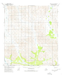
1972 Map of Arctic A-5
USGS Topo · Published 1976About this map
The Wind River drainage dominates the southwestern reaches of this remote Alaska interior landscape, mapped during a period of intensive photogrammetric survey in the early 1970s. The terrain is defined by the winding paths of Smoke Creek and Crow Nest Creek, which cut through the high-relief topography of the North Slope. These waterways serve as the primary landmarks in an area otherwise marked by unsurveyed land lines and jurisdictional markers like the South Boundary and Borough Boundary. This survey, based on 1972 aerial photography, captures the natural state of the Brooks Range foothills before modern developments, noting specific swampy lowlands and the orientation of the Umiat Meridian. The map serves as a primary record of the hydrography and elevation of this unsettled region at the time of its field annotation.
Find a feature on this map
6 named features on this map. Tap any name to fly to it.
Don’t see what you’re looking for? This feature index may not catch every label — zoom into the map to look around manually.
Map Details
Editions of this 1972 Arctic A-5 Map
This is the sole edition of this map. No revisions or reprints were ever made.
Other maps of this area

1951 · Chandalar
USGS Topo · 1:250,000

1951 · Christian
USGS Topo · 1:250,000

1951 · Brooks
USGS Topo · 1:250,000

1951 · Arctic
USGS Topo · 1:250,000

1956 · Arctic
USGS Topo · 1:250,000

1956 · Chandalar
USGS Topo · 1:250,000

1956 · Philip Smith Mountains
USGS Topo · 1:250,000

1956 · Christian
USGS Topo · 1:250,000

1964 · Chandalar
USGS Topo · 1:250,000

1964 · Philip Smith Mountains
USGS Topo · 1:250,000