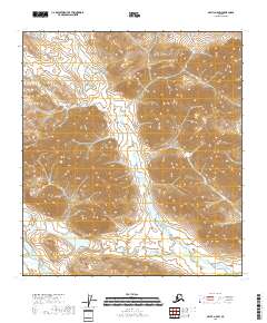
2018 Map of Arctic A-5 SW
USGS Topo · Published 2018About this map
Smoke Creek and its tributary Smoke Cr carve through the high elevations of the North Slope Borough in this 2018 topographic survey. The drainage network follows a southwesterly course, eventually feeding towards the Wind River which flows along the southwestern corner of the quadrangle. This landscape is defined by its dramatic relief, where deep valleys separate prominent ridges in a pattern typical of the Brooks Range foothills. The map provides a clear look at the intricate hydrography and elevation contours that dictate the movement of water across this Arctic environment, long before modern infrastructure reached these interior drainages. The absence of roads or permanent settlements highlights the wilderness character of the region, emphasizing the primary geographic landmarks used by travelers and researchers traversing the Alaskan interior.
Find a feature on this map
10 named features on this map. Tap any name to fly to it.
Don’t see what you’re looking for? This feature index may not catch every label — zoom into the map to look around manually.
Map Details
Editions of this 2018 Arctic A-5 SW Map
This is the sole edition of this map. No revisions or reprints were ever made.
Other maps of this area

1951 · Chandalar
USGS Topo · 1:250,000

1951 · Christian
USGS Topo · 1:250,000

1951 · Brooks
USGS Topo · 1:250,000

1951 · Arctic
USGS Topo · 1:250,000

1956 · Arctic
USGS Topo · 1:250,000

1956 · Chandalar
USGS Topo · 1:250,000

1956 · Philip Smith Mountains
USGS Topo · 1:250,000

1956 · Christian
USGS Topo · 1:250,000

1964 · Chandalar
USGS Topo · 1:250,000

1964 · Philip Smith Mountains
USGS Topo · 1:250,000