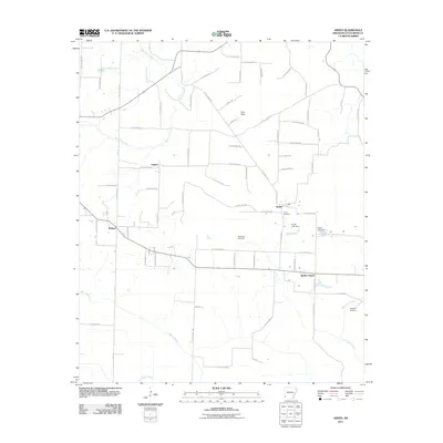
2011 Map of Arden
USGS Topo · Published 2011About this map
Arden and the surrounding rural pocket of Little River County are defined by a complex network of county roads and meandering watercourses. This landscape, located in the southwestern corner of Arkansas, is shaped by drainage features like East Flat Creek and Walnut Bayou, which weave through the low-lying Gum Flats. The settlement pattern centers on small communities such as Wallace and Pankov, connected by numerous Little River numbered routes. For the local historian or genealogist, the map preserves the locations of community anchors including Wades Chapel and the Arden Cemetery. Managed water features like Pullen Lake, supported by the Pullen Lake Dam and Sivley Lake Dam, indicate a landscape modified for local utility and recreation during the early 21st century.
Find a feature on this map
77 named features on this map. Tap any name to fly to it.
Don’t see what you’re looking for? This feature index may not catch every label — zoom into the map to look around manually.
Map Details
Editions of this 2011 Arden Map
This is the sole edition of this map. No revisions or reprints were ever made.
Other maps of this area

1950 · Redbank
USGS Topo · 1:24,000

1950 · Ashdown West
USGS Topo · 1:24,000

1950 · Barkman
USGS Topo · 1:24,000

1950 · Falls Chapel
USGS Topo · 1:24,000

1950 · Winthrop
USGS Topo · 1:24,000

1951 · Winthrop
USGS Topo · 1:24,000

1951 · Redbank
USGS Topo · 1:24,000

1951 · Ashdown West
USGS Topo · 1:24,000

1951 · Falls Chapel
USGS Topo · 1:24,000

1951 · Barkman
USGS Topo · 1:24,000