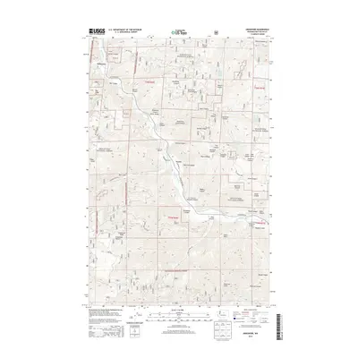
2014 Map of Ardenvoir
USGS Topo · Published 2014About this map
The Entiat River corridor serves as the primary artery through this high-elevation landscape, where the confluence with the Mad River near Ardenvoir marks a rare point of valley floor settlement. Most of the topography is defined by steep canyons and ridges within the Wenatchee National Forest, including Steliko Canyon and Dinkelman Ridge. The presence of the Entiat Fish Hatchery and the small hamlet of Farris highlights the community's historical reliance on the river ecosystem. Local history is anchored by landmarks like the Saunders Cem, situated above Saunders Canyon. The map reveals a complex network of forest access routes such as Entiat River Rd and Mills Canyon Rd, which trace the difficult terrain toward features like Peters Point and Dick Mesa.
Find a feature on this map
47 named features on this map. Tap any name to fly to it.
Don’t see what you’re looking for? This feature index may not catch every label — zoom into the map to look around manually.
Map Details
Editions of this 2014 Ardenvoir Map
This is the sole edition of this map. No revisions or reprints were ever made.
Other maps of this area

1901 · Chelan
USGS Topo · 1:125,000

1957 · Wenatchee
USGS Topo · 1:250,000

1968 · Orondo
USGS Topo · 1:24,000

1968 · Entiat
USGS Topo · 1:24,000
1968 · Cashmere
USGS Topo · 1:24,000

1968 · Tyee Mtn.
USGS Topo · 1:24,000

1968 · Ardenvoir
USGS Topo · 1:24,000

1968 · Baldy Mtn
USGS Topo · 1:24,000
1968 · Chumstick Mtn
USGS Topo · 1:24,000

1968 · Winesap
USGS Topo · 1:24,000