
1968 Map of Entiat
USGS Topo · Published 1972About this map
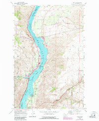
Lake Entiat dominates the landscape of the Columbia River valley in the late 1960s, a period marked by the complex infrastructure of power and transit along the Chelan and Douglas County line. The settlement of Entiat sits at the confluence of the Entiat River, characterized by civic staples like the Fire Sta and RR Station along the Burlington Northern line. Across the water, the east bank reveals a different character, where Brays Landing Road winds toward the Waterville Plateau and the small community of Orondo. Here, local life is anchored by the Orondo School, Orondo Community Cemetery, and a nearby Grange Hall. The terrain itself tells a story of geological history, with prominent landmarks such as Ribbon Cliff and the aptly named Earthquake Point rising above the reservoir waters, while the western edge transition into the protected lands of the Wenatchee National Forest.
Find a feature on this map
51 named features on this map. Tap any name to fly to it.
Don’t see what you’re looking for? This feature index may not catch every label — zoom into the map to look around manually.
Map Details
Editions of this 1968 Entiat Map
2 editions found
Other maps of this area

1901 · Chelan
USGS Topo · 1:125,000

1957 · Wenatchee
USGS Topo · 1:250,000

1968 · Chelan
USGS Topo · 1:24,000

1968 · Orondo
USGS Topo · 1:24,000

1968 · Waterville
USGS Topo · 1:24,000

1968 · Ardenvoir
USGS Topo · 1:24,000

1968 · Baldy Mtn
USGS Topo · 1:24,000
1968 · Douglas
USGS Topo · 1:24,000

1968 · Winesap
USGS Topo · 1:24,000
1968 · Rocky Reach Dam
USGS Topo · 1:24,000